Mapping Meadows for Reforestation with Locus GIS
Reforestation and conservation efforts require accurate mapping of existing meadows. The Locus GIS application has proven to be an invaluable tool for this purpose.
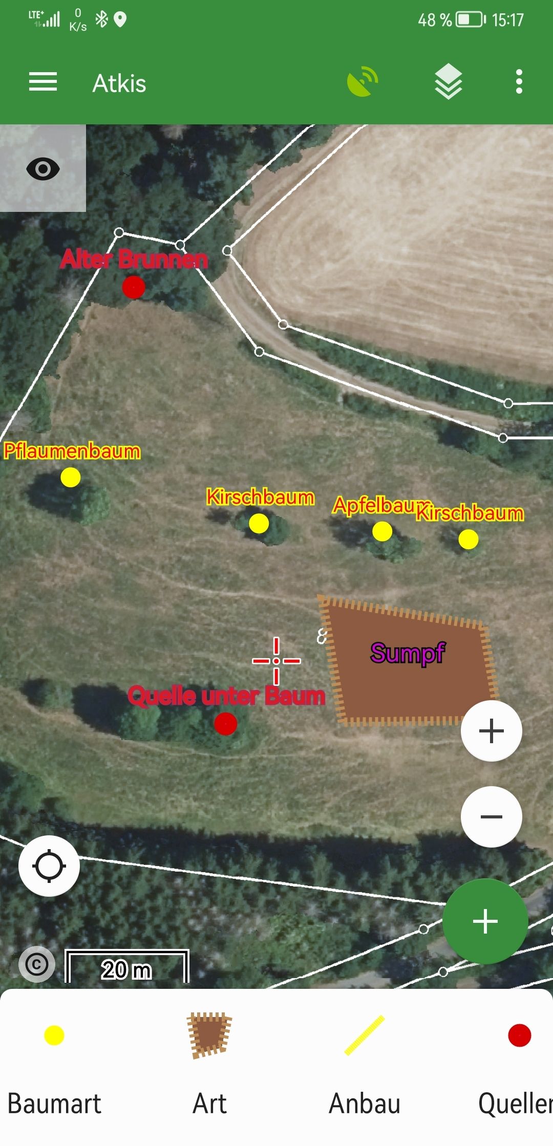
The process starts with aerial photos, provided by the WMS Service Hessen, which provide a comprehensive overview with boundaries. However, these photos often lack the detailed information needed for effective mapping, such as the presence of swamps, springs, and specific tree populations and species.
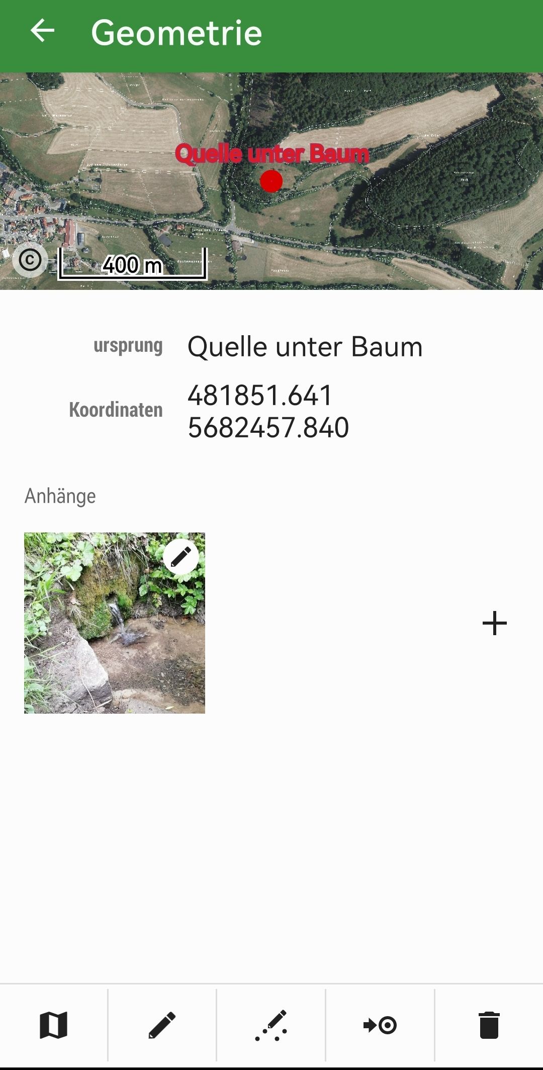
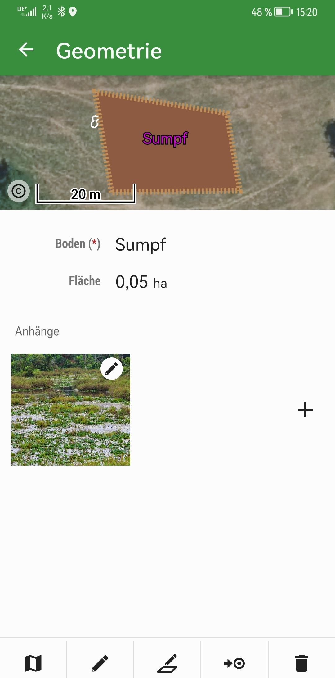
To capture these details, a smartphone is used to conduct a field survey with an accuracy of about three meters. Field data is meticulously cataloged by object and determined in the field.
One of the key features of Locus GIS is the ability to export data directly from the field as shapefiles, which can then be sent to the office for further processing. This data is easily imported into GIS software such as QGIS for detailed analysis and application.
The app’s ability to save photos and edit objects greatly enhances the workflow, making subsequent tasks much easier. Overall, the efficient mapping provided by Locus GIS has saved considerable time in the reforestation planning process.

Comments
0